Hoover · Neighborhoods
Hoover Neighborhoods: A Complete Guide
A guide to Hoover, AL neighborhoods: Bluff Park, Riverchase, Ross Bridge, Trace Crossings, Lake Cyrus and more, grouped by area with terrain and roads.
By Camden Davis · Updated
Hoover is big enough that "living in Hoover" can mean very different things. A wooded street on top of Shades Mountain, a lakeside cul-de-sac in a 1970s planned community and a brand-new house in the ridges south of I-459 are all Hoover, but they differ in age, terrain, walkability and daily routes. This guide groups the city's neighborhoods by area so you can see how they fit together. Each neighborhood has its own page, listed below as it goes live.
For the city overview, see the Hoover guide.
How Hoover's neighborhoods are organized
The ridges run northeast to southwest, and Hoover's neighborhoods follow them in bands.
On the mountain: Bluff Park and the streets along Shades Crest Road sit on the crest of Shades Mountain. These are generally the oldest areas, with winding roads, wooded lots and views.
At the foot of the mountain and in the valley: Green Valley, Star Lake and the Riverchase area spread across the valley between the mountain and I-459. Most homes here date from the 1960s through the 1980s, and this band holds the city's main shopping, the Galleria, the library and city offices.
South of I-459: Trace Crossings, Chace Lake, Southlake, Deer Valley and Russet Woods fill the rolling land around State Route 150 and the Hoover Met complex, mostly built from the 1980s onward.
The southwest edge: Ross Bridge, The Preserve, Brock's Gap, Lake Cyrus and Lake Wilborn are the newest large communities, set in steeper wooded ridges near Moss Rock Preserve.
The east side: parts of Greystone and Inverness on US 280 are inside Hoover, though they function as part of the Highway 280 corridor.
At a glance
| Neighborhood | Area | Typical era | Terrain | Main roads |
|---|---|---|---|---|
| Bluff Park | Shades Mountain | Early to late 1900s, mixed | Hilly, wooded | Shades Crest Rd, Alford Ave |
| Green Valley | Foot of the mountain | 1960s–70s | Gentle | I-65, Green Valley Rd |
| Star Lake | Central | 1960s–80s | Gentle, lake | US 31, I-65 |
| Riverchase | Central, I-459 | 1970s–90s | Rolling, lakes | I-459, US 31 |
| Chace Lake | South | 1980s–90s | Rolling, lake | US 31, SR 150 |
| Southlake | South | 1980s–90s | Rolling | US 31 |
| Trace Crossings | South | 1990s–2010s | Rolling | SR 150 |
| Deer Valley | South | 1980s–90s | Rolling, wooded | SR 150 |
| Russet Woods | South | 1980s–90s | Hilly, wooded | SR 150 |
| The Preserve | Southwest | 2000s on | Hilly, rocky | SR 150 |
| Ross Bridge | Southwest | 2000s on | Rolling to hilly | SR 150, Ross Bridge Pkwy |
| Brock's Gap | Southwest | 2000s on | Steep ridges | SR 150 |
| Lake Cyrus | Southwest | Late 1990s on | Rolling, lake | SR 150 |
| Lake Wilborn | Southwest edge | 2010s on | Hilly, lake | S. Shades Crest Rd |
Neighborhoods by area
On Shades Mountain
- Bluff Park: Hoover's oldest area, on the mountaintop, with views off the bluff, a small village center and the annual art show.
Central Hoover
- Green Valley: mid-century streets at the foot of the mountain with quick I-65 access.
- Star Lake: an established neighborhood around a lake with a walking trail.
- Riverchase: the 1970s planned community around the Galleria, lakes and a country club.
South of I-459
- Chace Lake: a lake and golf community near US 31 and State Route 150.
- Southlake: near US 31 toward Pelham and the Shelby County line.
- Trace Crossings: subdivisions around the Hoover Met complex.
- Deer Valley and Russet Woods: wooded, established streets off State Route 150.
The southwest edge
- Ross Bridge: a walkable planned community with a village center and golf resort.
- The Preserve: a traditional neighborhood design beside Moss Rock Preserve.
- Brock's Gap: newer homes in steep ridges near Ross Bridge.
- Lake Cyrus: neighborhoods around a lake on the city's edge.
- Lake Wilborn: one of the city's newest communities, around a wooded lake.
Comparing Hoover neighborhoods
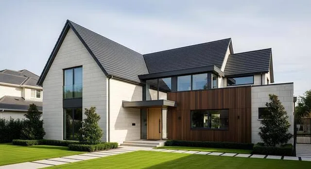
A few questions help narrow things down:
- Where will you drive every day? Northern neighborhoods are closer to Homewood, downtown and UAB by I-65 or US 31. Southwest neighborhoods are closer to Bessemer and Tuscaloosa. The Highway 280 side is closer to Mountain Brook and the 280 office parks.
- Do you want to walk places? Ross Bridge and The Preserve were designed for it; most other areas are built around the car.
- Old or new? Older neighborhoods offer mature trees and established streets; newer ones offer recent construction and HOA-maintained amenities.
- How do you feel about hills? Bluff Park and the southwest ridges have steep lots and winding roads; the valley neighborhoods are gentler.
- Which county? South and east Hoover includes Shelby County areas with different property tax rates.
Getting around between neighborhoods
Hoover's size means that moving between its neighborhoods can take as long as a trip downtown. A few routes do most of the work: I-459 crosses the middle of the city, linking the south side to I-65, US 31 and US 280; US 31 runs over the mountain and through the commercial core; State Route 150 serves the south and southwest; and South Shades Crest Road follows the mountain from Bluff Park toward the southwest neighborhoods. Living near the road you use most often makes a bigger difference to daily life than almost anything else.
Parks and outdoor spaces by area
- Mountain neighborhoods: Moss Rock Preserve's trails and boulders, plus the views along Shades Crest Road.
- Central neighborhoods: the Star Lake trail, Aldridge Gardens and Veterans Park.
- South and southwest: the Hoover Met complex fields, Ross Bridge's greens, community lakes and Moss Rock Preserve's southern trailheads.
- East side: the Cahaba River and Oak Mountain State Park just beyond the city.
Schools and city services
Every address inside Hoover city limits is served by Hoover City Schools and city services, whether it is in Jefferson or Shelby County. Some addresses with a Hoover mailing address are outside the city. Confirm zoning with Hoover City Schools and see official data on the Alabama State Department of Education report card site.
Related guides
Frequently asked questions
What are the main neighborhoods in Hoover, AL?
Well-known Hoover neighborhoods include Bluff Park, Riverchase, Ross Bridge, Trace Crossings, Lake Cyrus, Brock's Gap, The Preserve, Star Lake, Green Valley, Chace Lake, Southlake, Deer Valley, Russet Woods and Lake Wilborn, plus parts of Greystone and Inverness on the Highway 280 side.
Which Hoover neighborhoods are oldest?
Bluff Park on Shades Mountain is generally considered Hoover's oldest area, and neighborhoods near the base of the mountain such as Green Valley and Star Lake are largely mid-century. Planned communities south of I-459 are mostly from the 1990s onward.
Which Hoover neighborhoods are walkable?
Ross Bridge and The Preserve were designed in a traditional neighborhood pattern with sidewalks and small town centers. Most other Hoover neighborhoods are car-oriented, with curving streets and cul-de-sacs.
Do all Hoover neighborhoods use Hoover City Schools?
Addresses inside Hoover city limits are served by Hoover City Schools, in both Jefferson and Shelby counties. Some homes with a Hoover mailing address are outside city limits, so confirm with the district.